Wyoming Department of Transportation’s chief geologist, James Dahill, is a 36-year veteran of the agency. Though he’s seen several landslides over his career, the “Big Fill” landslide in early June was a first on Teton Pass.
“This one did obviously catch everyone off guard, although we had been keeping our eye on this corner for the last 5 to 10 years and correcting it,” said Dahill.
Dahill noted that high groundwater levels were a key factor that led to the “Big Fill” landslide.
“When it’s really high, it weakens or loosens up—or lubricates is a better word—the soils. And then those soils tend to mobilize or move,” explained Dahill.
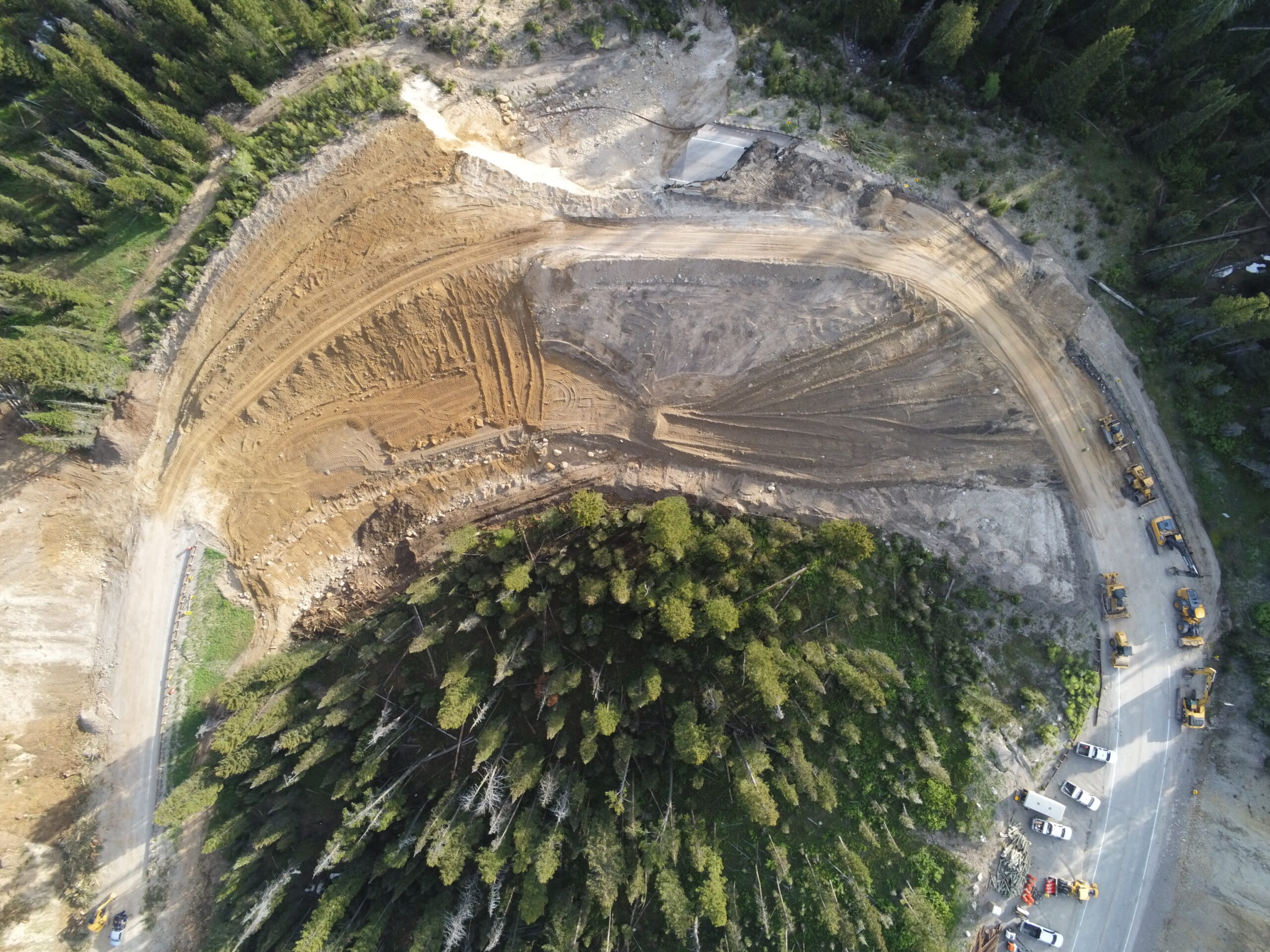
A drone photo captures the temporary detour under construction on Teton Pass, just south of the location of the Big Fill landslide. (Photo courtesy of WYDOT)
When asked about whether geologists could predict or forecast landslides, Dahill pushed back.
“No, I’m not a good Johnny Carson. I cannot make those kind of predictions.”
Dahill was referencing a bit from the late-night talk show host, playing “Carnac the Magnificent,” who could “divine” unknown answers to unseen questions.
While Mother Nature can be unpredictable, some indicators were there before the landslide, including a rapid increase in temperature in the days leading up to the slide
“You guys had a really wet May up here. And also, the rapid rise in temperature last week. The temperatures increased 20, 25 degrees over a day or so,” said Dahill.
Landslides are more common in the spring.
Stephanie Harsha, a public relations specialist with the Wyoming Department of Transportation, said that the best they can do is identify problem areas quickly and respond promptly.

Geologist James Dahill draws a cross-section of the slide and the planned detour. (Emily Cohen/KHOL)
The response to the “Big Fill” landslide did come quickly. Officials first noticed a crack in the roadway at mile 12.8 following a motorcycle crash on Thursday, June 6. They patched the roadway to get the evening commute through. However, by the next morning, a 200-foot mudslide at milepost 15, just west of the landslide, shut down the road.
The mudslide—and subsequent road closure—proved an unexpected blessing for WYDOT and may have even saved the lives of drivers who rely on the route to commute between Teton County and Idaho.
Measuring landslide movement isn’t always easy for the naked eye to see—and when it is visible, it is usually too late.
“We put up some temporary measures, which meant a lathe on the ground, and we just measured the offset as it was moving,” said Dahill.
Dahill said his team initially measured the land moving one inch per hour, which then accelerated to 6 inches per hour before the slope completely slid, ultimately resulting in the “catastrophic failure” of the roadway.
Dahill said that the location of this slide is not related to any deeper geologic instabilities, such as fault movement. The Teton Range is technically along an active fault that is continually pushing the Tetons upwards. However, according to Teton County Emergency Management, there haven’t been any major earthquakes in recorded history.
“We have not detected any geologic instabilities, i.e. fault movement, seismic activity, earthquake activity,” said Dahill. “It’s just we’ve added a lot of water to a site that normally drains sufficiently.”
Dahill emphasized that the Earth’s forces are in constant motion, even if we can’t see them.
“Erosion never stops. Just like gravity never stops,” said Dahill.
Crews will be working nonstop to get a detour built by the end of June and to rebuild the roadway by November.