This story comes to KHOL through the Rocky Mountain Community Radio collaborative.
When it comes to water in the West, a lot of it is visible. Snow stacks up high in the mountains then eventually melts and flows down into valleys. It’s easy to see how heavy rains and rushing rivers translate into an abundance of available water. But another important factor of water availability is much harder to see.
Beneath the surface, the amount of moisture held in the ground can play a big role in how much water makes it down to rivers and reservoirs–and eventually into the pipes that feed homes and businesses.
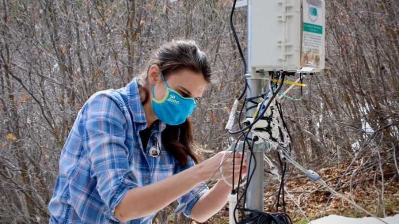
Elise Osenga is a community science manager for the Aspen Global Change Institute–a nonprofit focused on expanding scientific understanding of climate change. She gathers data from 10 soil moisture monitors in Colorado’s Roaring Fork Valley. The river is a tributary to the Colorado River, on which 40 million people throughout the southwest rely to supply drinking and irrigation water.
“I can’t tell you what the rain is going to do,” Osenga said. “But I can tell you where we’re starting out with soil moisture and snow scientists can tell you where we’re starting out with snowpack and that can help you to realize what’s coming ahead.”
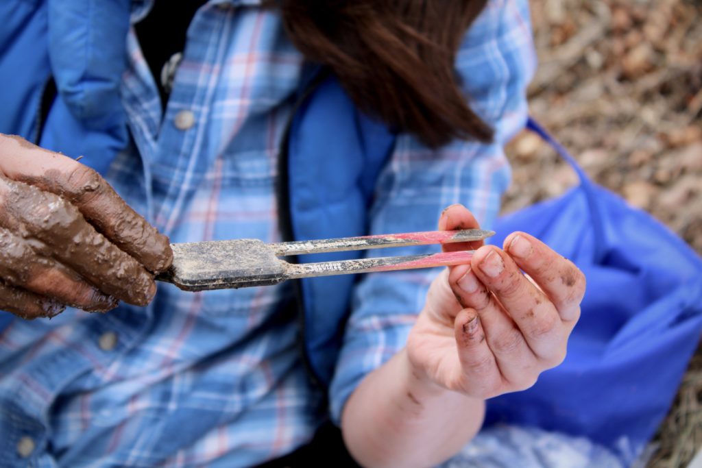
Each monitoring station uses metal prongs buried in the soil. By sending an electrical signal from one prong to another, they are able to gauge the amount of water held in the dirt. (Alex Hager/Aspen Public Radio)
When dirt is saturated, more water from rainfall and snowmelt will trickle into streams and rivers. When the ground is dry, it acts like a sponge, soaking up precipitation and holding it in the ground.
“If you have dry soils, snow melts and you’re not going to see as much runoff,” Osenga said. “But if you take a year where maybe you had the exact same snowpack, but you went in with really, really wet soils, those soils can’t take up as much water. So you’re going to see a higher runoff from that same amount of snowpack.”
That is not the case this year, as soil in many parts of the Colorado River basin is parched. By the time snow starts melting this spring and summer, less of it will make its way to the streams that supply cities and farmers.
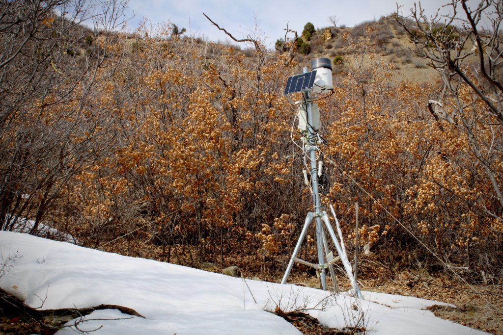
One of Osenga’s monitors is tucked away in a dense thicket of scrubby brush on a hillside above Glenwood Springs, Colorado, just a stone’s throw from the Colorado River. It’s a metal tripod adorned with boxes, monitors and wires heading underground, where a set of metal prongs uses electrical signals to measure the amount of water held in the soil.
Those data, combined with findings from the other stations in the region, are informative in both the short term and the long term.
Water managers who decide how much water cities and towns can sustainably use each year can consult that data to figure out how much snowmelt might reach rivers each summer. That is especially important in a small city like Aspen, where much of the water supply is drawn directly from streams rather than stored in a reservoir. Other smaller communities throughout the West rely on streamflow or underground springs or groundwater for their drinking supply rather than drawing from big reservoirs.
This soil moisture monitoring station near Glenwood Springs, Colorado, is part of a network of 10 in the area. Gathering data from a variety of locations helps researchers track long-term climate changes. (Alex Hager/Aspen Public Radio)
Osenga said the network of monitors is spread across a variety of sites in the area to help with some of the long-term data collection.
“We wanted to pick 10 spots that would represent different types of ecosystems and different elevations across the valley,” she said. “And the reason we wanted to have that elevational spread is because we’re really curious about climate change impacts.”
Those impacts are a bit hard to measure because researchers are working with a limited data set when it comes to soil moisture. The Natural Resources Conservation Service–a federal authority on snowpack and Colorado’s watersheds–only has soil moisture data going back 10 to 15 years.
Brian Domonkos, a hydrologist and Colorado Snow Survey supervisor for the NRCS, said the agency can start to confidently extrapolate patterns after about 30 years of data collection. Despite the dearth of long-term records, he said recent years appear to be dry.
“We’re seeing that there is a trend of below-normal precipitation during the summer and that the soil moisture is getting quite dry,” Domonkos said. “Even with normal precipitation or snowpack right now on top of those dry soils we would have below normal runoff.”
Snowpack data, which draws on about a century of observations, shows a slight decrease in annual volume over time.
Although measuring soil moisture is relatively new for environmental scientists, it’s a practice that has a long history in the world of agriculture. Farmers and ranchers know that the water levels underground will play a role in the crops they grow, and how they irrigate the land.
Casey Piscura is the owner and director of Seed Peace, an agricultural research nonprofit. He works at Sunfire Ranch outside of Carbondale.
“When you are coming into a season like this one where you see lower than normal snowpack, the amount of water that can be held in the soil is essential to being more efficient with the water that we have when we know it’s going to be limited,” he said.
Piscura pays close attention to soil health. The composition of dirt can affect its capacity to hold water and sustain crops. That capacity comes into play when he is making decisions about irrigation.
“Without good water and good soil moisture,” he said, “We really are limited in the quantity and quality of things that we can grow. So, it’s essential.”
Keeping tabs on soil moisture may become increasingly important. Piscura and other farmers say long-term changes in climate conditions could lead to “desertification” in the area–a process in which previously fertile land dries out and loses its ability to grow viable crops.
An understanding of soil moisture is significant outside of farming, too. Headlines in the West often tout high or low snowpack as reasons to be hopeful or anxious. But the water levels underground are just as important, Osenga said.
“It’s important for understanding whether or not you’re going to be in a drought,” Osenga said. “I think this year in particular, everyone in Colorado is kind of standing with their hair on end thinking, ‘Are we going to be in a real serious drought next year?’”
With snowpack hovering below average throughout the Colorado River Basin, and dry soil making it even harder for that snow to reach rivers and streams when it melts, this winter’s indicators hint at another dry summer. Without improvement, that could put parts of the region on track for water usage restrictions and increased risk of wildfire.
This story is part of ongoing coverage of the Colorado River basin, produced by Aspen Public Radio, distributed by KUNC, and supported by the Walton Family Foundation.
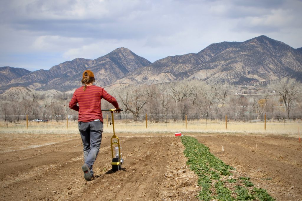
Sara Tymczyszyn plants seeds at Highwater Farm in Silt. Although measuring soil moisture is relatively new for environmental scientists, it’s a practice that has a long history in the world of agriculture. (Alex Hager/Aspen Public Radio)

