This story comes through a content-sharing partnership with Wyoming Public Media.
Roads can sometimes be a death sentence for wildlife. A project that just wrapped up in southwest Wyoming hopes to fix that.
State and local officials gathered on Thursday, Oct. 12, on a stretch of U.S. Highway 189 between Big Piney and Labarge. They were bundled up in big orange jackets, knit beanies and felt cowboy hats, bracing for the snowy weather to come.
“Throw a little bad weather at us, and we’ll just be really quick with our talks,” joked Angie Bruce, deputy director of the Wyoming Game and Fish Department (WGFD).
Bruce spoke at the ribbon cutting for the $15.1 million project, largely supported by a federal grant, the Wyoming Transportation Commission, the Wyoming Game and Fish Commission and a number of other groups.
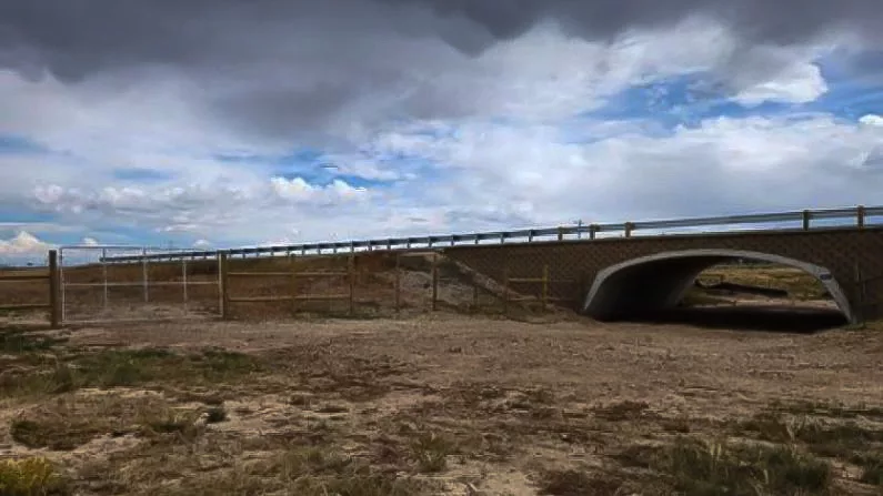
The project includes nine highway underpasses with 17 miles of 8-foot-tall fencing lining the road. The hope is this’ll encourage wildlife to use the underpasses, rather than crossing the busy road.
“When I think of the future, I hope we’re not doing these,” Bruce said of the ribbon cutting. “What I hope is that wildlife crossings are a normal, expected, regular part of our highway system, and that they’re incorporated into all that we do. We won’t have to have a special recognition, it will just be part of the highway system.”
Highway 189 sees a lot of mule deer from the Wyoming Range, which is one of the largest mule deer herds in the world. From 2018 till 2020, about 68 carcasses were picked up from being hit by cars.
“Even as a young man driving from Big Piney to LaBarge, this time of year, you could almost literally walk on the backs of dead deer along this highway,” said Bob Budd, executive director of the Wyoming Wildlife and Natural Resource Trust.
So far, the data shows that wildlife crossings can prevent this. There are seven underpasses on Highway 30 west of Kemmerer, and according to WGFD, there has been an 81 percent decline in deer-vehicle collisions in the past three years.
The WGFD has created a map that shows ‘high collision’ areas across the state to help with future wildlife crossing projects.


